Sunday, July 27, 2008

DAY #11 - GLOUCESTER TO ISLES OF SHOALS, NH/ME

JULY 27TH, 2008


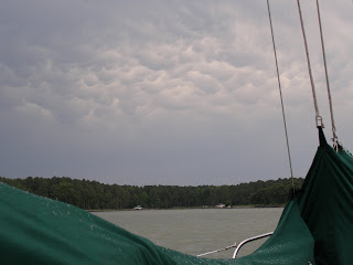
Storms last night and storms predicted this afternoon so we picked a weather window and headed out for Isles of Shoals (shoals is an older term for schools of fish). Isles of Shoals is a small group of islands about six miles off the coast. The New Hampshire and Maine border slits the island group. Along the way we passed the paired light houses on Thacher Island, Mass..


28.5 NM

DAY #10 - ONSET TO GLOUCESTER, MASS

JULY 26TH, 2008


We headed north through the Cape Cod Canal with the favorable current and dumped out in Cape Cod Bay after refueling. While sailing across Cape Cod Bay we each saw whales but they are usually to quick for photos. Daylight ran out so we ducked into Gloucester, Mass. and anchored behind the breakwater and the light house. Gloucester is a historic fishing harbor and we saw several very old castle like buildings.


62.8 NM

DAY # 9 - FISHERS ISLAND TO ONSET, MASS.

JULY 25TH, 2008


Time to go - tired of sitting still. The weather is looking favorable so we hauled anchor and departed in "pea-soup" fog. It finally lifted enough to see the Point Judith light as we passed. We continued on and turned up Buzzards Bay and finally anchored in the little harbor of Onset, Mass. (which is just before the Cape Cod Canal). Passage through the canal has to be timed with the tidal current.


73.1 NM

Thursday, July 24, 2008

FISHERS ISLAND

DAY 7 & 8 - JULY 23RD & 24TH, 2008

We are holed up at Fishers Island (which is just off shore New London, Conneticut). Storms and high winds out of the east have put us on hold for a couple of days.


We saw our first windjammers today. One that anchored nearby was painted light pink. I think seafarers of the past would roll over in their watery graves if they saw what had been done to this traditional ship.

0 NM

PORT JEFFERSON TO FISHERS ISLAND

DAY 6 - JULY 22ND, 2008

We headed east on Long Island Sound to Fishers Island.


56.5 NM

ATLANTIC HIGHLANDS TO PORT JEFFERSON, NEW YORK

DAY 5 - JULY 21ST, 2008


We rode the current through the East River and New York City. Then we travelled east on Long Island Sound to Port Jefferson, New York (which is on the north shore of Long Island).


"Dear - How would you like to take our seaplane and fly in to Manhattan today?"


They have also found an inovative way to house the bad boys and girls.

The midday heat had us looking forward to the coolness of the northern waters. The deck of the boat was too hot to walk on with bare feet.


Those who live on Long Island have a slightly different way of life. Most people commute to work --- some by car, some by train, some by ferry, and some even by helicopter.


72 NM

ATLANTIC CITY TO ATLANTIC HIGHLANDS, NEW JERSEY

DAY 4 - JULY 20TH, 2008

We left early and set out north along the coast to Atlantic Highlands (which is just south of New York City). This is always a difficult and long stretch of the Jersey coast. Today was no exception. Intermittent storms along the way did not help.

87.1 NM

DAY 3 - BREAKWATER HARBOR TO ATLANTIC CITY, NEW JERSEY

JULY 19TH, 2008

We sailed up the south Jersey coast to Atlantic City where we anchored in Rum Cove.


Lets hope a hurricane never hits this part of the coast. Each time we visit there are more condos and casinos being built just above sea level. What are these people thinking. I know - $$$.


We finished out the busy week by attending "Prairie Home Companion" services while enjoying the sunset. Of course, we could have gone ashore to the "Water Club" or some other casino but I think we had the best deal in town.


54.1 NM

DAY 2 - STILL POND TO BREAKWATER HARBOR, DELAWARE

JULY 18TH, 2008


Today we passed through the C&D canal, at the north end of the Chesapeake Bay, and then down the Delaware Bay to Breakwater Harbor which is behind Cape Henlopen.


87.7 NM

DAY 1 - SOLOMONS TO STILL POND, MARYLAND

JULY 17TH, 2008

After three days at the marina we are finally heading out. What a relief!


First impressions:
The cool freshness of the early morning sea air.
The slow roll of the boat under our feet due to the wake of a fishing boat passing in the distance.
The swirl of schools of small bait fish just under the water surface.
The glimmer on the water of the morning sun still low in the sky.
The peacefullness of the early morning out on the water.
The calm hum of Mr. Perkins pushing us along.
The sunlight casting sparkling diamonds across our path.
Water boiling with bait fish being chased by larger fish.
Breeze tossed hair.
The grey outline of a container ship in the shipping channel.
Crab buoys bobbing like apples on the water.
Fluttering birds perching atop fish trap stakes.
The gentle rocking of the boat as we move along.
Delicate foam swirling around the boat like the fine lace of a fancy woman's petticoat.
Whitewashed light house station on the western shore of the bay brillant in the morning sun.


We travelled north on the Chesapeake Bay and finally anchored at Still Pond for the night.

69.1 NM

FINALLY

JULY 13, 2008

Finally, after 2.5 weeks of preparation, we are heading for Solomons, Maryland to start our sailing vacation.

This year we hope to sail to Canada and explore Nova Scotia and maybe the south coast of Newfoundland for the first time.

We will attempt to continue this blog so that our friends and family might stay informed as to our progress. However, this year the entries will be briefer and have fewer pictures. Maintaining a detailed log on the blog in remote areas is nearly impossible. When we enter Canada our entries may be few and far between.

Saturday, July 5, 2008

ST. LEONARD CREEK TO SOLOMONS

JUNE 3, 2008

Time to head for home and back to work. We motored the short distance back to our home port where we made our last needed maintenance list and prepped the boat for our next big trip. This included putting the dinghy on top of the cabin and adding heavier dock lines since hurricane season is on its way.


We also met a couple other Cape Dory owners at the marina.
CD 27 - Whirlaway
CD 33 - Maggie Rose


8.5 NM

BROAD CREEK TO ST. LEONARD CREEK (OFF PATUXENT RIVER)

JUNE 2, 2008

The post-front northwest wind was not supposed to last so we sailed off the anchor at 8:00am (that's early for us) and headed south so that we would be closer to our home port. Sailing is our R & R time so we usually sleep in and leisurely enjoy a couple cups of coffee each morning while enjoying the scenery and activities on the water. The wind finally shifted and then died as we approached the Patuxent River so we motored the rest of the way up the Patuxent River and into St. Leonard Creek. We anchored in a very nice spot off of Breedens Point. We went swimming and exploring in the dinghy.


Towards evening time a replica of an old sailing vessel entered the creek and anchored. It was too far away to see its name.

41.1 NM

HUDSON CREEK TO BROAD CREEK

JUNE 1, 2008

The wind was light so we ghosted up the Bay to the Choptank. As storms approached we motored into Broad Creek and anchored. Broad Creek turned out to be a quiet creek with large homes along the shore.


Once again the storms were followed by a pretty sunset.


Air temps: 80s - daytime
50s - night
Water temp: 66

21.8 NM

2ND 2008 SHAKEDOWN MINI CRUISE (SOLOMONS TO HUDSON CREEK)

MAY 31, 2008

Storms were predicted but we headed out anyway. We were anxious to get going and the Chesapeake is full of gunkholes that one can duck into.


I included the photo of a horn buoy for those of you who have never seen one. As the heavy buoy bounces up and down in the swell, air is pushed through a vertical pipe which causes the horn to blow.


We sailed north on the bay and finally turned into the Little Choptank and Hudson Creek when we saw serious storms approaching. We pulled down our sails just as the storms overtook us. We clocked wind speeds of 45 - 50, along with heavy rain and hail, during the storm which lasted 30 - 60 minutes. It was fun and a good learning experience. It was the first time that we had been out (not anchored) during such strong winds. We got to see how the boat handled the weather. It was surprising how much the heavy displacement boat heeled over when broadside to the wind.


After the storm passed we had a very pretty sunset to go along with our sundowners.

27.1 NM